G318 Sichuan-Tibet Highway:
Foreign Driver Regulations & Mountain Guide
The definitive route intelligence for China National Highway 318. Verified foreign driver access limits, the Chengdu-to-Batang independent legal sector, Jinsha River TAR checkpoint protocols, high-altitude pacing, and vehicle requirements.
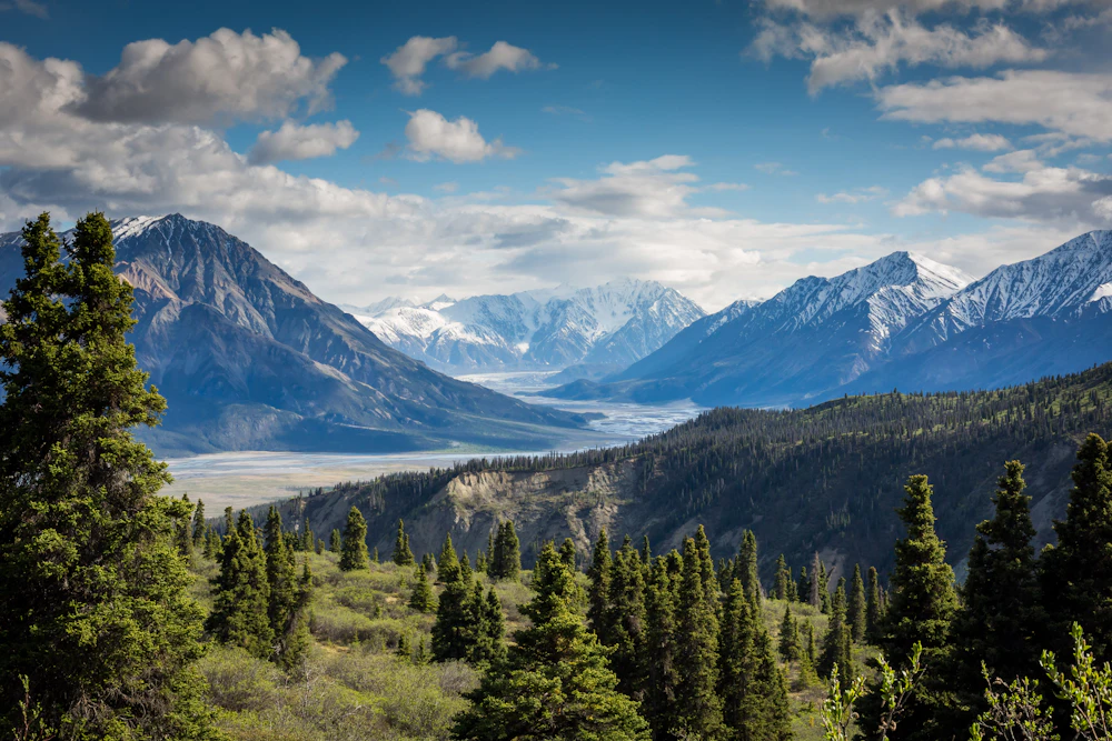
Chengdu to Lhasa: 14 High Mountain Passes
Complete foreign driver guide: police checkpoints, oxygen canisters, and EV supercharger corridors.
G318 Is NOT 100% Open for Independent Foreign Self-Drive
While Chinese marketing heralds G318 as "China's Ultimate Road of Wonder" (中国人的景观大道), international travelers must understand the strict provincial frontier divide:
Foreign drivers with a valid Chinese Provisional Driving Permit may legally rent a car in Chengdu and drive freely across all of Western Sichuan (Ya'an, Kangding, Xinduqiao, Litang, and Batang). No Tibet permits are required.
Crossing the Jinsha River bridge into the TAR strictly requires a Tibet Travel Permit (TTB Permit), licensed local tour guide escort, and pre-arranged registered vehicle. Self-driving independent rental cars across the TAR border is strictly prohibited.
G318 Sichuan-Tibet Highway: Segment Breakdown
Explore the 2,142-kilometer corridor from Chengdu to Lhasa broken down into eight distinct operational segments. Review elevation profiles, road engineering standards, and exact legal authorization boundaries.
Chengdu to Kangding (via Ya'an & Luding)
Kangding to Xinduqiao & Tagong Grassland
Xinduqiao to Yajiang & Litang
Litang to Batang (Sichuan Frontier)
Batang to Jinsha River TAR Border Checkpoint
Mangkam to Zogang & Baxoi (TAR Eastern Highlands)
Baxoi to Ranwu Lake, Bomi & Nyingchi
Nyingchi to Lhasa (Linla High-Grade Highway)
Elevation Profile & Acclimatization Protocol
Driving G318 involves climbing from the subtropical Chengdu Basin (500m) over mountain passes exceeding 5,000 meters. Understanding safe altitude step-up is vital to avoid acute mountain sickness (AMS) and medical evacuation.
| Waypoint | Elevation (m / ft) | Physiological Acclimatization Guidance | Sleep Feasibility |
|---|---|---|---|
Chengdu (Basin Floor) 成都平原 | 500 m 1640 ft | Baseline oxygen level (100%). Complete vehicle rental checkout and purchase medical supplies. | Comfortable baseline sleep. No altitude symptoms possible. |
Kangding (Gateway Gorge) 康定市 | 2560 m 8400 ft | Atmospheric oxygen ~75%. Ideal intermediate altitude stop to trigger natural erythropoietin production. | Highly Recommended Night 1 Stop. Minor restlessness possible; stay hydrated and avoid alcohol. |
Zheduo Mountain Pass 折多山垭口 | 4298 m 14101 ft | Atmospheric oxygen ~60%. Stop for photos for 15–20 minutes maximum. Do not run or jump for pictures. | Transit viewpoint only. Never attempt to camp or overnight here. |
Xinduqiao (Photographer's Corridor) 新都桥镇 | 3300 m 10826 ft | Atmospheric oxygen ~68%. Mild headache or breathlessness on stairs is standard. Drink 3+ liters of water. | Recommended Night 2 Stop. Superior hotel infrastructure with heated rooms and oxygen concentrators. |
Litang (World's High City) 理塘县城 | 4014 m 13169 ft | Atmospheric oxygen ~61%. Walking pace must be halved. Avoid heavy greasy food; monitor pulse oximeter. | Caution for Unacclimatized Drivers. Many travelers suffer acute insomnia and headaches at 4,000m+. |
Batang (Jinsha River Valley) 巴塘县城 | 2580 m 8464 ft | Significant drop in altitude back to lush valley conditions. Immediate physical recovery and restorative oxygenation. | Strategic Night 3 Stop for Western Sichuan Circuit. Sleep deep before looping north toward Baiyu or Kangding. |
Dongda Mountain Pass (Highest Crest) 东达山垭口 (西藏昌都) | 5130 m 16830 ft | Extreme plateau altitude. Atmospheric oxygen ~53%. Temperatures remain sub-zero even in mid-summer. | Transit mountain pass only (TAR Permit section). Drivers must strictly descend immediately. |
Lhasa (Holy City Plateau) 拉萨市区 | 3650 m 11975 ft | Atmospheric oxygen ~65%. After driving through 4,000m passes, Lhasa feels noticeably comfortable and warm. | Terminal destination for guided Tibetan expeditions. Extensive luxury medical-grade oxygen hotels. |
Three Golden Rules for Safe Altitude Driving on G318
Cross high passes during daylight hours, but descend to sleep at lower elevations. For example, cross Zheduo Mountain (4,298m) to sleep in Xinduqiao (3,300m), and pass through Litang (4,014m) to sleep in Batang (2,580m).
Purchase 3 to 4 portable oxygen canisters (便携式氧气瓶, 15–25 RMB each) at pharmacies in Kangding before heading up Zheduo Pass. Use oxygen if severe throbbing headache or shortness of breath occurs.
Never drink alcohol for your first three days at altitude. Thin mountain air accelerates dehydration; aim for at least 3 liters of warm water or electrolyte beverages daily to support oxygen circulation.
Best Rental Vehicles for the G318 Sichuan Highway
While the entire Sichuan stretch of G318 is asphalt, high altitude power loss, steep gradient climbs, and occasional rockfall debris demand careful drivetrain selection. Here is how vehicle classes compare.
2.0T 4WD Rugged Body-on-Frame SUV
Turbocharged AWD Midsize Crossover
Naturally Aspirated Economy Sedan
Pure Electric Vehicle (BEV)
Planning to pick up your vehicle in Chengdu? Both Tianfu Airport (TFU) and Shuangliu Airport (CTU) have full national rental desks. Read our dedicated Chengdu car rental guide for pickup logistics.
Best Driving Seasons & Seasonal Road Hazards
Western Sichuan weather dictates road viability. Review our month-by-month seasonal risk calendar to choose the safest window for crossing G318 mountain passes.
May to June
Optimal WindowJuly to August
Monsoon RiskSeptember to October
Optimal WindowNovember to April
Winter Ice & SnowMandatory Snow Chains (防滑链) Policy
From late October through late April, Sichuan Traffic Police (四川交警) establish seasonal chain inspection checkpoints at the foot of Zheduo Mountain and Kazila Pass. When fresh snowfall or overnight black ice occurs, vehicles without mounted snow chains are barred from ascending. You can purchase rubber or iron cable chains in Kangding or Luding for approximately 150 to 300 RMB. Always test-mount them in dry conditions first.
Fuel Stations, EV Charging Corridors & Road Rescue
Modern G318 is no longer a wilderness track. Major state energy stations and superchargers are distributed along the highway, but smart refueling habits remain critical.
State-owned Sinopec (中石化) and PetroChina (中石油) stations are situated every 40 to 80 km along the Sichuan G318 corridor. Both 92# and 95# unleaded gasoline are universally stocked in Kangding, Xinduqiao, Yajiang, Litang, and Batang.
Huawei Liquid-Cooled Superchargers (600 kW) and State Grid DC fast-charging bays are operational in Ya'an, Kangding, Xinduqiao, and Litang. A compatible GB/T connector is required.
In case of accidents or mechanical breakdown on G318 in Sichuan, dispatch services are available via official provincial channels:
- • 122: National Traffic Police Accident Hotline
- • 120: Medical Emergency & Ambulance Dispatch
- • 0836-2811444: Garzê Highway Maintenance Rescue
- • 12122: Expressway Towing & Emergency Rescue
Bilingual Emergency & Police Checkpoint Cards
Mobile cellular signal can occasionally drop inside deep Hengduan gorges. Save or screenshot these verified bilingual phrases with exact Pinyin to display directly to traffic police, mechanics, or locals.
The Ultimate 8-Day Western Sichuan G318 Circuit
Because crossing into Tibet independently is prohibited, international road-trippers combine the best of G318 with G227 and G317 into a loop starting and ending at Chengdu.
Day-by-Day Route Progression:
Depart Chengdu on G4218 Ya-Kang Expressway. Pass through the 13.4 km Erlang Mountain Tunnel. Acclimatize in Kangding (2,560m).
Climb G318 over Zheduo Mountain Pass (4,298m). Photograph Mount Yala from Tagong Grassland. Sleep in Xinduqiao (3,300m).
Ascend via Tianlu 18 Bends and Kazila Pass (4,718m) to Litang. Turn south onto scenic G227 to Daocheng town (3,750m).
Park at the Shangri-La visitor center. Take scenic park shuttle to view Chenresig, Jambeyang, and Milk Lake. Sleep in Riwa (2,900m).
Return to G318 at Litang, traverse the Haizi Mountain plateau past Sister Lakes, and descend to Batang (2,580m) on the Sichuan frontier.
Follow the scenic Jinsha River valley north on S457/G215 past Baiyu Monastery to historic Derge, home to the Tibetan woodblock printing temple.
Travel east on G317 through the Que'er Mountain Tunnel and Luhuo to Danba Jiarong Tibetan stone watchtowers.
Drive past Mount Siguniang (Four Sisters Mountain) through the Balang Mountain Tunnel (3,800m) and descend back to Chengdu.
Frequently Asked Questions About G318
Direct, legally substantiated answers addressing foreign driver authorizations, altitude safety, vehicle rentals, and frontier checkpoints along China National Highway 318.
Q1Can a foreigner drive a rental car from Chengdu all the way to Lhasa along G318?
Q2Which specific section of G318 can foreign travelers legally drive on their own?
Q3What happens if an independent foreign driver attempts to cross the Jinsha River bridge into Tibet?
Q4Do I need a Border Defense Permit (边防证) for the Sichuan portion of G318?
Q5How severe is altitude sickness along G318, and what is the best itinerary pacing?
Q6What type of vehicle should I rent in Chengdu for driving G318?
Q7Are there electric vehicle (EV) charging stations along the G318 Sichuan route?
Q8When is the best time of year to drive G318 in Western Sichuan?
Q9Are snow chains legally mandatory on G318 during colder months?
Q10Can all hotels along G318 accept foreign passport holders?
Q11What should I do if my car suffers a puncture or mechanical failure in the mountains?
Q12How can I design a complete legal self-drive road trip around G318 without entering Tibet?
Design a Compliant, High-Altitude Road Trip in Western Sichuan
Navigating 4,000m+ mountain passes, booking foreigner-verified Tibetan hotels, and coordinating provincial car rentals requires local expertise. Let our specialized road trip consultants draft an exact, day-by-day GPS route plan tailored to your driving style.
Data on road classifications, foreign national checkpoint protocols, and high-altitude regulations on G318 are cross-referenced against official administrative bulletins published by the Sichuan Provincial Public Security Department Traffic Police Corps (四川省公安厅交通警察总队), Garzê Prefecture Department of Transportation (甘孜州交通运输局), and the National Highway Traffic Administration of the PRC.
Disclaimer: Mountain road conditions in the Hengduan Range and Tibetan Plateau are subject to rapid shifts due to seismic activity, landslides, and flash storms. Drive China Now provides verified research guidelines; travelers must obey all on-site commands issued by traffic police officers and check real-time navigation data via Amap (高德地图) or Baidu Maps prior to crossing any pass.