Qinghai-Gansu Grand Loop
The Ultimate 2,600 km Silk Road Circuit
The definitive day-by-day self-drive route through northwest China. Circle China’s largest salt lake, photograph surreal emerald brine pools and water yardangs in the Qaidam Basin, explore UNESCO Mogao Caves, and conquer the vibrant Rainbow Danxia and Qilian Mountain G227 pass. 100% legal for foreign motorists with zero permit barriers.
100% Unrestricted Foreign Self-Drive Clearance
The Qinghai-Gansu Grand Loop traverses entirely through Qinghai and Gansu provinces along public civilian highways (G109, G315, G30, G3011, and G227). Foreign travelers holding a valid passport and Chinese Provisional Driving Permit can freely rent cars in Xining or Lanzhou and drive independently. No Tibet Travel Permits, military border clearances, or mandatory tour guide escorts are required.
Services We Provide For This Expedition
青甘大环线 (丝路环线) • 官方合规配套服务
We solve the practical hurdles foreign drivers face in China: notarized license translations, foreign-passport car rental dispatch, and guaranteed hotel foreign-guest licensing along Qinghai-Gansu Grand Loop.
Certified License Translation
Official notarized-grade translation with Chinese agency double red seals and business license copy for your Provisional Driving Permit.
- 24–48h high-resolution digital delivery
- Accepted nationwide at airport traffic desks
- Official agency stamps + license copy included
Foreign Driver Car Rental Concierge
We match you to vetted Xining depots with verified foreign passport verification systems, ensuring smooth vehicle pickup and zero airport surprises.
- Pre-vetted Xining airport / city depot staff
- Deposit waiver & foreign credit card guidance
- SUV / AWD selection for mountain terrain
Custom Self-Drive Itinerary Plan
Ground-up personalized road book for Qinghai-Gansu Grand Loop: certified foreign-guest hotels (外宾资质), daily mountain driving pace, and offline GPS waypoints.
- 100% verified foreign-guest hotel list
- Includes free $99 Car Rental Concierge
- Bilingual driver cards for checkpoints & hotels
The 4 Core Driving & Safety Rules of the Grand Loop
Vital regulations on highway safety, desert refueling, and advance UNESCO cave bookings.
100% Unrestricted Foreign Self-Drive Clearance
Both Qinghai and Gansu provinces are open civil transportation regions. Foreign drivers do NOT need a Tibet Travel Permit (TTP), military clearance, or commercial tour guide. You only need your original passport, Chinese provisional driving permit (临时机动车驾驶许可), and car rental agreement.
Strict Photo Ban on G315 "U-Shaped Highway" Surface
The dramatic rollercoaster rises of G315 near Dachaidan became a viral social media photo sensation. However, heavy 49-ton mineral trucks crest these blind rises at 80 km/h with limited stopping distance. Traffic police deploy drone surveillance and issue severe fines (200 RMB + 3 demerit points) for stopping on the roadway. Pull completely into designated scenic viewing laybys.
Fuel Management Across the Qaidam Desert Basin
The desert stretch across the Qaidam Basin from Dachaidan through the Water Yardangs to Dunhuang spans over 450 kilometers with sparse fueling outposts. Remote desert stations occasionally undergo maintenance or experience fuel tanker delivery delays. Always top up your tank to 100% in Dachaidan.
Advance Online Reservation for Dunhuang Mogao Caves
To protect fragile thousand-year-old Buddhist murals, the Dunhuang Academy strictly caps daily visitor entries. Standard Type A tickets (including 8 caves + 2 digital cinema shows) sell out weeks in advance in July and August. Foreign passport holders can book directly using their passport numbers and request an English-speaking guide at no extra charge.
7-Day Step-by-Step Road Trip Itinerary
Precise daily distances, driving times, elevation profiles, highway conditions, and verified overnight stops.
Xining → Riyue Mountain → Qinghai Lake → Chaka Salt Lake (西宁 → 日月山 → 青海湖 → 茶卡镇)
Scenic Highlights: Crossing Princess Wencheng’s historic Riyue Mountain Pass, panoramic views of Qinghai Lake’s sapphire waters framed by July golden rapeseed flowers, sunset photography at Chaka Salt Lake ("Mirror of the Sky").
Chaka Salt Lake → Delingha → Xiaochaidan Lake → Dachaidan (茶卡 → 德令哈 → 小柴旦湖 → 大柴旦)
Scenic Highlights: Driving across the hyper-arid Qaidam Basin, poet Haizi’s beloved oasis city of Delingha, passing cobalt-blue Xiaochaidan Lake, sunset reflections over the vibrant green brine pools of Dachaidan Emerald Lake (翡翠湖).
Dachaidan → G315 U-Shaped Highway → Water Yardangs → Dangjin Pass → Dunhuang (大柴旦 → 水上雅丹 → 当金山 → 敦煌)
Scenic Highlights: The famous undulating G315 "U-Shaped Highway" ridge, the world’s only Water Yardang Geopark (乌素特水上雅丹), crossing the high Dangjin Mountain pass into Gansu, descending 2,500 vertical meters into Dunhuang oasis.
Dunhuang Silk Road Culture: Mogao Grottoes & Mingsha Shan (敦煌莫高窟 → 鸣沙山月牙泉)
Scenic Highlights: UNESCO World Heritage Mogao Caves (莫高窟) with pre-booked English-speaking expert guides, afternoon camel trekking across Mingsha Shan Singing Sand Dunes, sunset reflections at Crescent Lake (月牙泉).
Dunhuang → Guazhou Giant Sculptures → Yumen → Jiayuguan (敦煌 → 瓜州雕塑群 → 玉门 → 嘉峪关)
Scenic Highlights: Tasting sweet Hami melons at Guazhou roadside bazaars, photographing giant outdoor Gobi sculptures ("Son of the Earth" / 大地之子), the colossal wind turbine farms of Yumen, exploring the Ming Dynasty Great Wall Fortress at Jiayuguan.
Jiayuguan → Linze → Zhangye Rainbow Danxia (嘉峪关 → 临泽 → 张掖七彩丹霞)
Scenic Highlights: Morning departure across the fertile Hexi oasis corridor, arriving in Zhangye to visit the indoor Giant Buddha Temple (大佛寺), late afternoon photography of the vivid layered mineral siltstone of the Rainbow Danxia (七彩丹霞).
Zhangye → G227 Highway → Biandukou → Qilian Prairie → Menyuan → Xining (张掖 → 扁都口 → 祁连草原 → 门源 → 西宁)
Scenic Highlights: Climbing the crimson canyon of Biandukou into the glaciated Qilian Mountain range, crossing the boundless Qilian Prairie dotted with grazing yaks, the million-acre golden canola carpet of Menyuan, returning to Xining.
Estimated 7-Day Self-Drive Budget Model (2 Travelers)
Transparent cost breakdown based on authentic rental car rates, expressway tolls, UNESCO park tickets, and quality hotels:
| Expense Category | Estimated Cost (RMB) | Approx. (USD) | Operational Breakdown |
|---|---|---|---|
| Rental Vehicle & Fuel (Sedan or SUV / 7 Days) | 3,800 – 6,200 RMB | ~$530 – $870 USD | Based on compact SUV (Haval H6) or sedan rental in Xining plus ~1,600 RMB gasoline (92#/95#) for 2,600 km. |
| Expressway Tolls (S89, G3011, G30) | 380 – 520 RMB | ~$53 – $73 USD | Tolls apply on expressway sections (Xining to Chaka, G30 Hexi Corridor). National Highway G227 is 100% toll-free. |
| Scenic Area Tickets & Eco-Shuttles | 1,800 – 2,600 RMB | ~$250 – $360 USD | Covers Qinghai Lake Erlangjian, Chaka Salt Lake mini-train, Dachaidan Emerald Lake, Mogao Caves Type A, and Zhangye Danxia. |
| Hotel Accommodations (7 Nights / 2 Travelers) | 3,500 – 6,800 RMB | ~$490 – $950 USD | Quality foreign-authorized hotels in Chaka, Dachaidan, Dunhuang (2 nights), Jiayuguan, Zhangye, and Xining. |
| Dining & Specialty Food (7 Days / 2 Travelers) | 1,800 – 3,000 RMB | ~$250 – $420 USD | Qinghai roasted yak ribs, Tibetan yogurt, hand-grabbed mutton (手抓羊肉), Dunhuang yellow noodles with donkey meat. |
| Estimated Total Per Person (Double Occupancy) | 5,700 – 9,500 RMB | ~$790 – $1,330 USD | Highly economical self-drive budget covering rental car, fuel, tolls, upscale hotels, all UNESCO tickets, and meals. |
6 Critical High-Plateau Realities You Must Know Before Driving
Driving across Qinghai-Gansu Grand Silk Road & Tibetan Plateau Loop (青甘大环线) is not an ordinary sightseeing road trip. Western China's extreme altitudes, strict checkpoint regimes, and remote mountain infrastructure create unique barriers that generic Western travel blogs fail to mention.
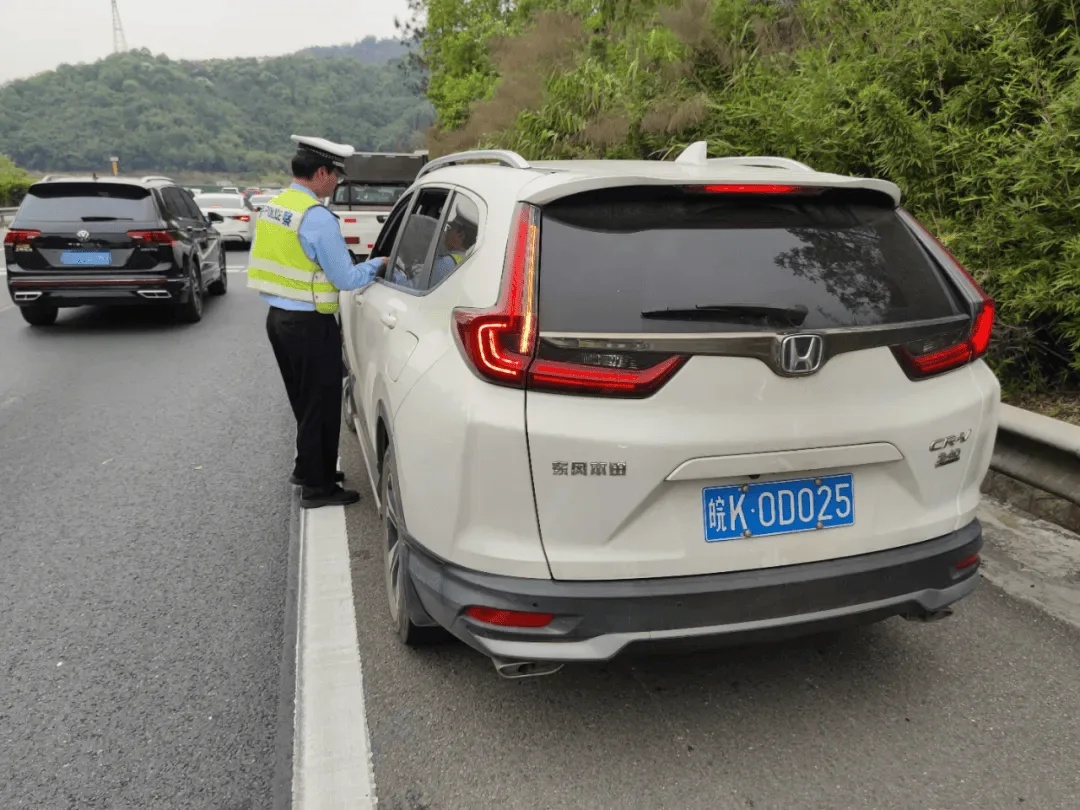
Frontier Passes & Police Checkpoints
- Frontier Pass Mandate: Sensitive border corridors (Pamir Plateau, Taxkorgan, western frontiers) strictly require a valid Frontier Pass (边防通行证) issued in advance for foreign passports.
- High-Density Security Checkpoints: Checkpoints along alpine highways require all vehicle occupants to exit for passport facial verification; foreign passports cannot use automated gates, causing delays.
- Zero-Drone Exclusion Zones: Flying consumer drones near border corridors, high mountain passes, and energy/military infrastructure is strictly prohibited; radar systems seize equipment instantly.
- Sudden Pass Access Controls: High-altitude roads (like Duku Highway or mountain passes) close abruptly for military convoys, mudslides, or weather; automated navigation fails to report remote closures.
- Restricted Village Entry: Certain frontier grazing tracts and border settlements are strictly closed to overseas visitors; unauthorized entry leads to police questioning and turnaround.
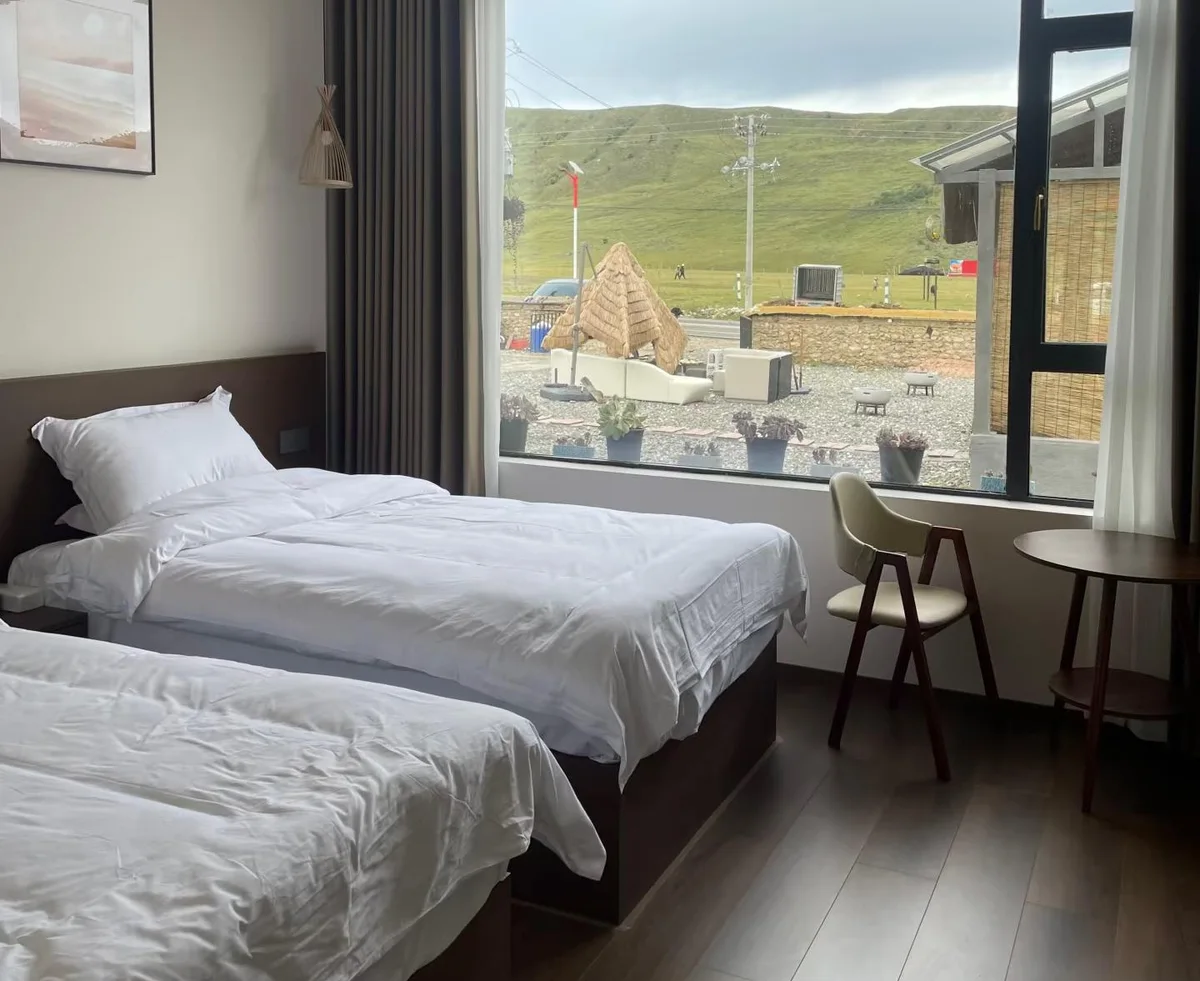
PSB Foreign Hotel Licensing Trap
- 60%+ Hotels Unlicensed: Over 60% of rural Tibetan guesthouses and roadside inns along western corridors lack Public Security Bureau (PSB) foreign guest entry terminals and cannot legally host you.
- Online Booking Mirage: Booking a room on Western booking sites does not guarantee check-in; front desks will flatly turn away foreign passports if their municipal system cannot scan foreign credentials.
- Sub-Zero Midnight Rejection: Arriving after an 8-hour mountain drive in freezing -5°C temperatures with no available licensed beds is a frequent, dangerous reality for uninformed DIY drivers.
- Hypothermia & Insulation Failure: Unlicensed budget motels lack central floor heating or dual-pane glass, drastically increasing severe hypothermia risks and rapid onset of pulmonary edema.
- Peak Season Scarcity: The limited certified foreign-compliant hotel rooms in hub towns (Bome, Bayi, Litang, Taxkorgan) sell out months ahead between June and October, driving surge prices.

AMS Hypoxia & Medical Emergency
- Rapid Elevation Shock: Ascending from low valleys to mountain passes over 4,000m within 24 hours induces Acute Mountain Sickness (AMS) in over 70% of unconditioned foreign drivers.
- "Climb High, Sleep Low" Rule: Sleeping at extreme elevations (like Litang 4,014m) on night 2 without staging triggers severe hypoxia; medical guidelines demand sleeping lower before pushing higher.
- HAPE & HACE Deterioration: High-Altitude Pulmonary or Cerebral Edema can develop within 6 to 12 hours from unmanaged headaches, requiring immediate emergency descent of at least 1,000 vertical meters.
- Zero English Emergency Care: Local township clinics and county hospitals have zero English-speaking personnel, no direct international insurance billing, and minimal ICU resuscitation capacity.
- Mini Can Oxygen Inadequacy: Disposable tourist spray cans provide less than 2 minutes of continuous oxygen; vehicles must be pre-equipped with 5L+ medical-grade oxygen generators.
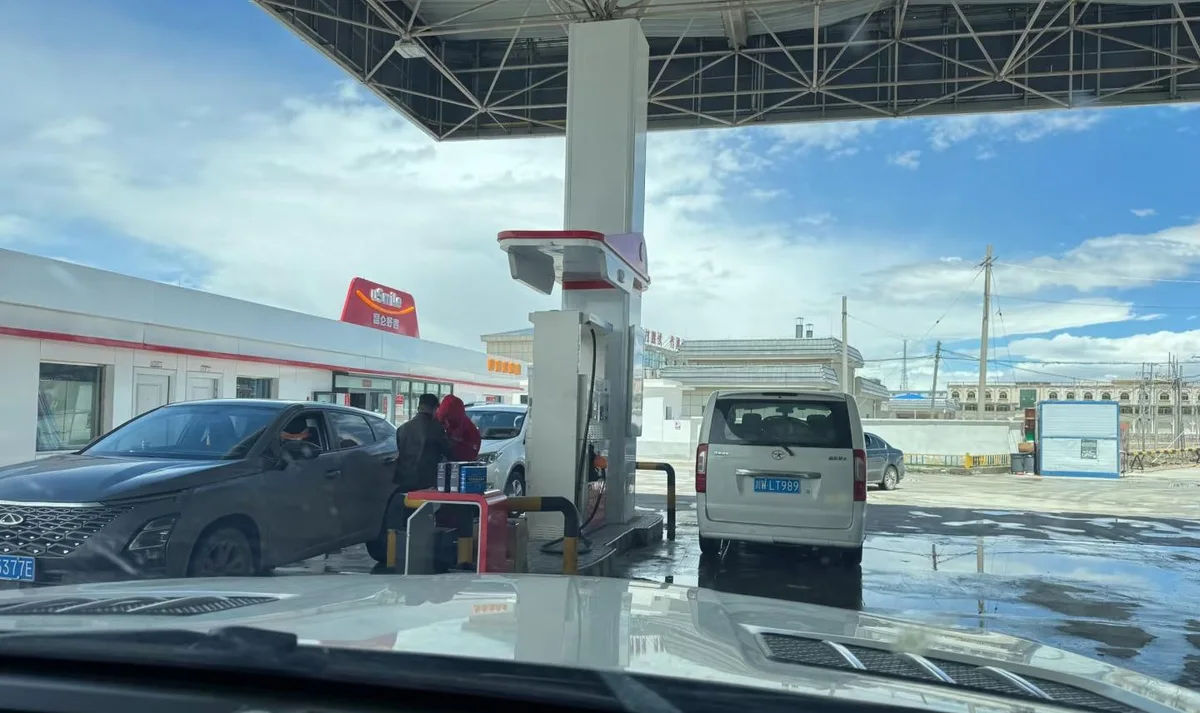
Gas Station ID Locks & Cold EV Drag
- Mandatory National ID Scan: Most PetroChina & Sinopec dispensers in sensitive plateau counties require scanning a Chinese Resident National ID (身份证) before the fuel nozzle mechanically unlocks.
- Manual Police Logging Delays: Foreign passport holders must locate the on-duty station manager for manual police registry photography, often delaying journeys by 40–60 minutes per fill-up.
- 200km+ High-Octane Supply Gaps: Premium 95 and 98-octane fuel frequently runs dry in remote mountain depots, risking engine knocking or complete stranding between distant service plazas.
- 40%–50% EV Range Collapse: Sub-zero mountain pass temperatures and cabin heating load slash electric vehicle range in half, with heavy liquid-cooled charging cables freezing rigid.
- 3x Energy Burn on Climbs: Sustained 30km uphill climbs consume energy at triple the standard rate; flatland dashboard estimates lead directly to battery exhaustion in dead zones.
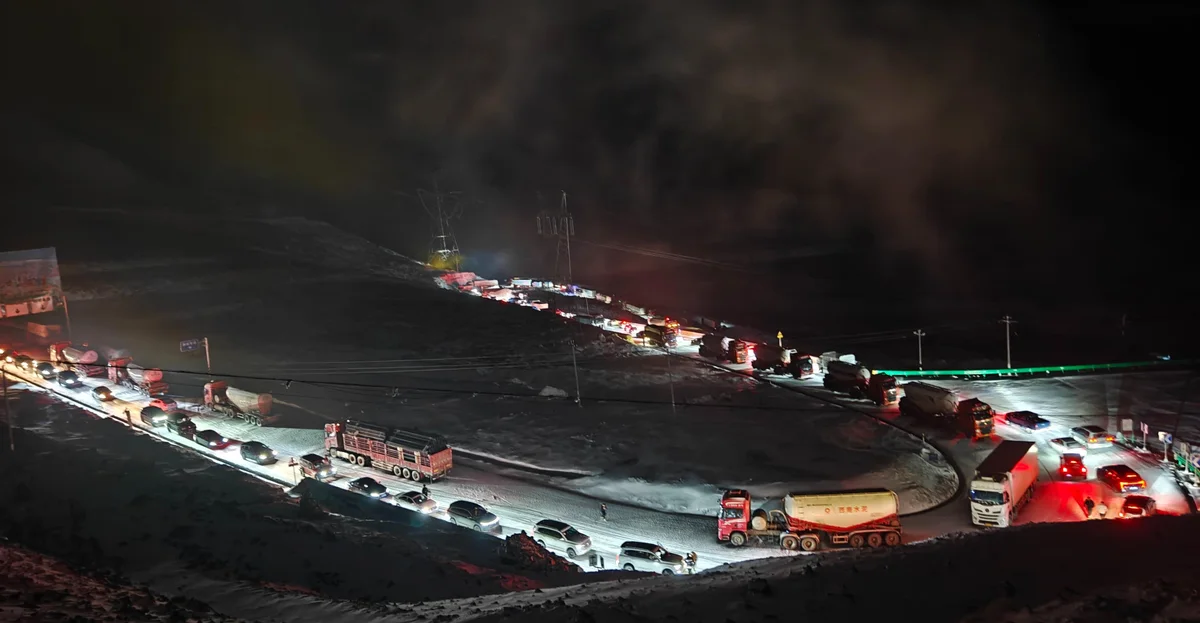
Blizzards, Landslides & Night Gridlock
- Rainy Season Mudslides (Jun–Aug): High-mountain gorges suffer massive rockfalls and mud avalanches, regularly cutting highway access for 24 to 72 hours without detour options.
- Sub-Zero Summer Blizzards: Even in midsummer, passes above 4,000m experience sudden whiteouts, trapping hundreds of vehicles overnight in freezing gridlock.
- Brake Fade on Switchbacks: Descending steep hairpin switchbacks continuously overheats brake pads; improper low-gear engine braking causes catastrophic brake failure.
- Invisible Black Ice (暗冰): Morning shadows and tunnel entrances conceal slick ice sheets, making standard rental tires skid violently without emergency snow chains.
- 35% Engine Power Drop: Naturally aspirated rental engines lose over a third of their horsepower in thin air, turning high-altitude overtakes around blind cliffs into lethal gambles.
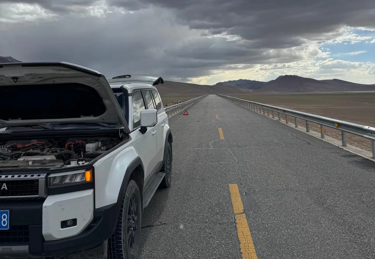
Zero-Signal Zones & No-Rescue Voids
- 50km+ Cellular Dead Zones: Deep canyon crevices and uninhabited mountain stretches have zero mobile signal; international roaming and Google Maps crash entirely without local offline tiles.
- No English 122/12122 Dispatch: Highway emergency rescue (12122) and police accident lines (122) operate exclusively in Mandarin; foreign drivers cannot communicate precise mile markers.
- 6–12 Hour Tow Arrival Times: In remote passes, the nearest heavy flatbed tow truck is hundreds of kilometers away, with commercial rescue fees exceeding 3,000–8,000 RMB.
- Lethal Hypothermia Risk When Stalled: If your vehicle battery or heating fails at 4,500m altitude at night, cabin temperature drops below -10°C within 30 minutes, risking acute hypothermia.
- Chinese GPS Audio Only: High-precision localized hazard alerts (Amap/Baidu) for imminent rockfalls, police radar, or tidal lanes are only broadcast in Chinese voice navigation.
Why High-Plateau Driving Demands an Expert Itinerary Blueprint
A generic travel blog tells you where the scenery is pretty. It will not tell you which checkpoint will seize your rental keys, which county inn will turn away your passport in -5°C midnight cold, or how to avoid fatal cerebral edema at 5,000 meters.
- •Turned back at Jinsha River checkpoint; 10+ days vacation and flights completely wasted.
- •Midnight check-in rejection by unlicensed county motels; forced to sleep in freezing cars.
- •Stranded at gas stations unable to unlock fuel pumps without a Chinese Resident ID.
- •Severe altitude sickness and ICU visits due to reckless 3,500m single-day elevation spikes.
- •Helpless in zero-signal mudslide closures with no English-speaking emergency assistance.
- •100% Legally Compliant Routing: Checkpoint protocols & pre-screened foreign travel permits.
- •Verified Foreign-Licensed Hotels: Pre-screened lodgings with confirmed public security capability (外宾资质).
- •Bilingual Navigation Waypoints: Chinese characters & Pinyin cards for seamless Amap (高德) entry.
- •Medical Elevation Pacing: Scientifically sequenced "climb high, sleep low" stages preventing acute AMS.
- •Alternative Plan B Road Book: Severe weather & mountain pass landslide detour contingency guides.
Seasonal Climate Windows & Canola Bloom Timing
The high Northwest plateau displays sharp seasonal contrast from midsummer golden canola fields to crystal autumn skies.
Peak Summer (July – August)
Canola Bloom & Lake Blues (5 / 5 Stars)The crown jewel season of the Northwest. Millions of acres of bright yellow canola flowers carpet the shores of Qinghai Lake and Menyuan valley against sapphire water and snowcapped peaks. Cool, refreshing alpine temperatures provide relief from eastern China’s summer heat.
Golden Autumn (September – October)
Crisp Skies & Autumn Foliage (4.8 / 5 Stars)Crystal-clear sapphire skies, zero rainfall, and stunning autumn colors across Qilian mountain birch forests. Harvest season fills oasis bazaars with sweet melons and grapes. Tourist crowds drop significantly after September 1st.
Late Spring (May – June)
Low Crowds & Awakening Steppes (4 / 5 Stars)Migratory birds flock to Qinghai Lake Bird Island; grasslands turn vibrant fresh green. Salt lakes are calm and mirror-flat with minimal wind ripple. Excellent hotel rates and effortless ticket availability.
Winter (November – April)
Snow-Dusted Silence (Specialist Trip)Qinghai Lake freezes into giant turquoise ice plates; snow dusts the Great Wall and Dunhuang sand dunes. Deeply atmospheric with virtually zero tourists. Off-season half-price tickets at Mogao Caves.
Vehicle Selection & Fleet Recommendations
Covering 2,600 km across salt flats, desert basins, and mountain passes requires reliable automotive capability.
e.g. Haval H6, Geely Xingyue L, Honda CR-V. Higher ground clearance easily navigates uneven salt-flat parking lots and gravel viewing turnouts. Roomy trunk accommodates multiple large suitcases and drinking water cases.
e.g. VW Passat, Toyota Camry. Outstanding fuel economy across 2,600 km of flat expressway, and lower center of gravity provides excellent high-speed stability against Yumen desert crosswinds.
While G30 has fast chargers, long desert gaps on G315 across the Qaidam Basin lack high-power DC charging. High summer AC load and 120 km/h cruising drain batteries quickly. Gasoline ICE ensures seamless 5-minute fill-ups.
Bilingual Emergency Flashcards for Northwest Motorists
Cell phone voice translation apps will drop offline in remote desert stretches. Screenshot these verified Mandarin and Pinyin emergency cards to present to police officers, toll operators, or gas station attendants.
Frequently Asked Questions (FAQ)
Detailed answers covering vehicle rental, Mogao Caves ticket reservations, G315 photo rules, and altitude management.
Can foreign tourists legally rent a car and drive the Qinghai-Gansu Grand Loop independently?
Yes, 100% legally and without any tour agency or permit restrictions. Both Qinghai and Gansu provinces are standard open civil travel regions. Foreign passport holders who obtain an official Chinese Provisional Driving Permit (临时机动车驾驶许可) can rent a vehicle at Xining Caojiapu Airport (XNN) or Lanzhou Airport (LHW) and drive the entire 2,600 km loop completely independently. You do not need a tour guide, government escort, or Tibet Travel Permit (this loop stays entirely north of the Tibet Autonomous Region boundary).
What is the starting and ending city for the Qinghai-Gansu Grand Loop?
Xining (the provincial capital of Qinghai) is the traditional and most logical springboard for the circular loop. Renting your car in Xining allows you to drive counter-clockwise: Xining → Qinghai Lake → Chaka Salt Lake → Dachaidan → Dunhuang → Jiayuguan → Zhangye → Qilian Mountains (G227) → returning to Xining. Alternatively, you can start in Lanzhou (Gansu), which is connected to Xining by a 1.5-hour high-speed train or a 2.5-hour highway drive.
How severe is altitude sickness along the Qinghai-Gansu Loop?
Altitude on this loop is mild to moderate compared to Tibet. Xining sits at 2,200 m, Qinghai Lake at 3,200 m, Chaka at 3,050 m, and Dachaidan at 3,170 m. When you cross into Gansu at Dunhuang, elevation drops to a warm, oxygen-rich 1,140 m. The highest mountain passes on the driving route (Riyue Mountain at 3,520 m and Jingyangling on G227 at 3,792 m) are crossed in your vehicle without sleeping at the summit. Mild symptoms (light headache, breathlessness on stairs) may occur on Days 1 and 2; drink plenty of water, avoid heavy alcohol, and carry a portable oxygen canister in the car.
Can a standard sedan drive the entire 2,600 km loop, or is an SUV mandatory?
Over 98% of the Qinghai-Gansu Grand Loop is paved with modern high-speed expressways (G30, G3011, S89) and well-maintained national highways (G109, G315, G227). A standard compact sedan (such as a Volkswagen Lavida or Toyota Corolla) can easily drive the entire route during the spring, summer, and autumn seasons. However, renting a compact or midsize crossover SUV (such as a Haval H6 or Geely Boyue) provides greater ground clearance for occasional unpaved parking lots at salt lakes, higher seating positions for admiring vast desert horizons, and more luggage room.
How do I book tickets for the Mogao Grottoes in Dunhuang with a foreign passport?
Booking in advance is mandatory during high season (June through October). The official Mogao Grottoes WeChat mini-program ("莫高窟参观预约网") allows booking up to 30 days in advance. Select "Type A Ticket" (which includes 8 caves and two digital cinema shows), choose your entry time slot, and enter your foreign passport number. On the day of your visit, take your physical passport to the "Online Booking / Foreign Passport Ticket Collection" window at the Mogao Caves Digital Exhibition Center to print your paper pass. The Dunhuang Academy provides professional English-speaking guides at no additional charge.
What is the "U-Shaped Highway" on G315, and is it legal to take photos there?
The "U-Shaped Highway" refers to dramatic undulating highway dips and roller-coaster rises through mineral-rich sandstone dunes on National Highway G315 near Dachaidan (approx. KM 780). While it is visually stunning, stopping your vehicle on the road surface or sitting in the traffic lane to pose for photos is STRICTLY ILLEGAL and enforced by police drone patrols and mobile speed cameras. Stopping in an active 80 km/h lane where heavy mineral trucks have blind crests is suicidal. Park only at designated paved viewing turnouts and photograph from the roadside shoulder.
When is the best time to see the yellow canola flowers at Qinghai Lake and Menyuan?
The golden canola bloom peaks from July 10 to August 5 each year. During these three to four weeks, the southern shores of Qinghai Lake (near Erlangjian) and the entire Menyuan basin along G227 are covered in vibrant yellow flower carpets contrasting against deep blue alpine water and glaciated Qilian peaks. If traveling in September, the flowers are harvested, but the birch forests of the Qilian Mountains turn brilliant golden-orange.
Where can I refuel and what fuel grades are available?
PetroChina and Sinopec mega-stations are located in every town: Xining, Huangyuan, Chaka, Delingha, Dachaidan, Dunhuang, Guazhou, Yumen, Jiayuguan, Zhangye, and Menyuan. 92# and 95# gasoline and 0# diesel are universally available. Mobile payment (WeChat Pay / Alipay) and Chinese bank cards are accepted at all pumps. Between Dachaidan and Dunhuang across the desert, fuel stations can be 150 km apart—never depart Dachaidan without a 100% full tank.
Can electric vehicles (EVs) complete the Qinghai-Gansu Grand Loop?
While State Grid (国家电网) fast-charging stations have been installed at major expressway service areas along G30 and G3011, driving a pure battery EV through the remote Qaidam Desert Basin (G315 Water Yardangs section) remains challenging due to sparse charging facilities and long distances between towns. Strong desert crosswinds and highway speeds of 120 km/h also increase EV battery drain by 25% to 35%. A gasoline engine (ICE) or plug-in hybrid (PHEV) ensures seamless travel without charging anxiety.
Are hotels along the loop authorized to accommodate foreign passport holders?
In major cities (Xining, Dunhuang, Jiayuguan, Zhangye), almost all 3-star, 4-star, and 5-star hotels have electronic foreign guest registration capabilities. In smaller rural stopovers like Chaka Town and Dachaidan, most modern commercial hotels and boutique inns cater to foreign tourists. When booking on Trip.com, use the "Foreign Guests Welcome" filter, or contact the front desk in advance to confirm they can scan your passport into the local public security system.
What is the speed limit and how is it monitored along the loop?
Expressway sections (G30, G3011, S89) generally have a speed limit of 120 km/h for passenger cars and 100 km/h for heavy trucks. National Highway G227 through the Qilian Mountains has a speed limit of 60 to 80 km/h, dropping to 40 km/h through town settlements. Traffic police heavily utilize section average speed cameras (区间测速) on G30 and G3011. Always run Amap (高德地图) connected to Bluetooth audio for real-time camera alerts and speed chime warnings.
What clothing and gear should I pack for the Qinghai-Gansu Loop?
Because the route spans elevations from 1,140 m to 3,800 m, layered clothing is essential: (1) A windproof and waterproof shell jacket; (2) A warm fleece or lightweight down jacket for cool mornings at Chaka and Qinghai Lake; (3) High-UV polarized sunglasses (essential for cutting intense glare on the white salt crusts of Chaka and Emerald Lake); (4) Broad-spectrum sunscreen (SPF 50+) and lip balm for dry desert air; (5) Bright red, white, or blue clothing for striking high-contrast photography on the white salt flats.
Next Step: Connect Your Northwest China Road Trip
Explore companion road guides across western China, car rental desks in Xining and Lanzhou, and custom trip planning services.
Full deep-dive on the Biandukou and Menyuan pass.
Speed limits, crosswinds, and fortress tolls.
Caojiapu airport pickup and provisional permit desks.
Mogao Caves ticket booking and hotel verification.