Panlong Ancient Road:
600+ Hairpin Curves in Tashkurgan
"Today you have navigated all the detours of life; from now on, your journey is smooth." Conquer the legendary Pamir switchbacks descending from 4,200 meters into Wacha Township. 100% legal for foreign motorists with Chinese provisional licences.

Conquer the legendary Pamir switchbacks descending into Wacha Township. 100% legal for foreign drivers.
Foreign Driver Clearance & Checkpoint Protocols for Tashkurgan
Panlong Ancient Road is situated entirely within Taxkorgan Tajik Autonomous County (塔县).Foreign travelers do NOT require the domestic Frontier Defense Permit (边境通行证) that Chinese citizens must obtain. Foreign tourists pass through the Gez Frontier Inspection Station (盖孜检查站) on G314 simply by presenting their original physical passport and valid Chinese visa/visa-free entry.
Tashkurgan to Wacha: Milestone & Elevation Waypoints
Step-by-step waypoint log covering the 34 km mountain pass and the return canyon route back to Tashkurgan.
Tashkurgan County Town Springboard (塔什库尔干县城 / 塔县)
The vibrant Tajik cultural heart of the eastern Pamir Plateau. Drivers stage here overnight to acclimatize before attempting Panlong. Foreign travelers stay in approved hotels with electronic PSB registration. Fuel tanks must be topped up here.
Western Entry Arch & Slogan Monument (西侧入口/"人生所有的弯路"标牌)
The official starting portal of Panlong Ancient Road. Home to the legendary roadside inscription: "今日走过了人生所有的弯路,从此人生尽是坦途" ("Today you have navigated all the detours of life; from now on, your journey is smooth"). One-way traffic enforcement cameras begin here.
Big Panlong Hairpin Switchback Ascent (大盘龙全景路段)
The road ascends through expansive, sweeping switchback bends climbing up the brown shale ridges of the Pamirs. Views open out to the glaciated massif of Mount Muztagh Ata (7,509 m) and the Kongur Tagh range in the distance.
Panlong Mountain Pass Crest (盘龙古道最高山口观景台)
The crest of the Wacha mountain divide. At 4,200 meters, atmospheric oxygen is roughly 60% of sea level. Spectacular 360-degree views looking down upon the tight, cascading coils of Small Panlong below. Strong mountain winds year-round.
Small Panlong Extreme Hairpin Descent (小盘龙密集弯道群)
The most famous and technically demanding segment. Over 200 ultra-tight hairpin curves packed into just 5 kilometers of roadbed, resembling a giant dragon coiling down the cliff. Mandatory low-gear engine braking (L / 1st / 2nd gear) to prevent brake rotor failure.
Wacha Township Eastern Exit (瓦恰乡出口/下板地水库联络线)
The completion of the hairpins. Drivers enter the tranquil willow-lined farming valley of Wacha Township. From here, drivers complete the loop back to Tashkurgan via the turquoise waters of Xiabandi Reservoir (下板地水库) and the Tashkurgan River canyon (approx. 70 km total loop).
The 4 Unbreakable Rules of Panlong Ancient Road
Due to precipitous cliff edges and dense switchbacks, strict driving protocols are enforced by local traffic authorities.
Strict One-Way Traffic Direction (单向通行规则)
During tourist peak periods (May to October), Panlong Ancient Road operates under strict ONE-WAY traffic control. Vehicles must enter from the western portal on G314 and exit east toward Wacha Township. Driving in reverse against the flow of traffic on these blind, narrow switchbacks is extremely dangerous, strictly prohibited, and monitored by automatic license plate cameras.
Vehicle Dimension & Seating Limitations
The turning radius on Small Panlong hairpins is exceptionally tight (some inner corners have an effective turning radius under 8 meters). Large commercial coaches, 9-seater passenger vans, heavy trucks, and extended motorhomes (RVs) physically cannot negotiate the switchbacks without executing 3-point turns over the cliff edge.
Low-Gear Engine Braking on Descent
Small Panlong drops over 600 vertical meters across continuous hairpins in under 15 minutes. Riding your footbrake continuously causes brake pads and discs to overheat past 450°C, boiling the brake fluid and leading to catastrophic total brake fade (刹车热衰退失灵). Downshift to let engine compression control vehicle speed below 25 km/h.
No Parking on Inner Hairpin Corners
Because of the dramatic serpentine visual angles, excited tourists are tempted to stop their vehicles in the middle of a hairpin to take photos. This creates severe bottleneck jams and forces trailing vehicles to brake to a dead stop on 14% grades. Park exclusively in marked outer turnouts.
Big Panlong vs Small Panlong: Anatomy of 639 Curves
The mountain road is split into two radically different driving characters before and after the 4,200 m summit.
Big Panlong (大盘龙段)
Expansive vistas of barren slate canyons, Kongur Tagh glaciated peaks, and distant mountain ridges.
Small Panlong (小盘龙段)
The quintessential "coiling dragon" photo spot, looking down at ribbon-like loops hugging sheer brown cliffs.
Frontier Security & Gez Checkpoint Guidelines
Tashkurgan borders Pakistan, Afghanistan, and Tajikistan. Follow these established immigration and security procedures.
Gez Frontier Checkpoint (盖孜检查站) on G314
Located at KM 1,595 of the Karakoram Highway (G314) between Kashgar and Tashkurgan. All vehicles must stop. International travelers must present their original passport and valid Chinese visa/visa-free entry. Officers register your documents into the border database. The process is smooth and takes 10 to 15 minutes.
Do Foreign Drivers Need a Frontier Defense Permit (边境通行证)?
No. The domestic "Border Frontier Permit" (边境管理区通行证) issued in Kashgar is only applicable to mainland Chinese citizens holding a Resident ID Card. Foreign passport holders cannot obtain this domestic document and do NOT need it to visit Tashkurgan county town, Karakul Lake, Baisha Lake, or Panlong Ancient Road—your original valid foreign passport is the legal clearance document.
Restricted Frontier Zones Around Tashkurgan
While Panlong Ancient Road and the Tashkurgan valley loop are fully open for foreign tourism, international travelers CANNOT independently drive into sensitive military border corridors, such as unauthorized side roads leading to the Pakistan, Afghanistan (Wakhan Corridor), or Tajikistan border fences.
Drone Flying Rules on the Pamir Plateau
Panlong Ancient Road is one of the most famous drone-filmed roads in China. Flying camera drones over the switchbacks is generally permitted for personal travel videos. However, you must NEVER fly drones within 15 km of the international border line, near military observation towers, or over police checkpoints.
Seasonal Climate Windows & Opening Calendar
The high Pamir passes experience severe winter freezes. Plan your self-drive within the official open window.
Autumn (September – October)
Ultimate Scenic Window (5 / 5 Stars)The gold standard for Pamir road trips. The willow trees along Wacha Township and the Tashkurgan River glow golden-yellow against snowcapped peaks. Clear, dry skies provide sharp visibility for drone aerials and road photography.
Summer (June – August)
Vibrant Green Valleys & Peak Season (4.5 / 5 Stars)Warmest driving weather. The grasslands around Tashkurgan and Wacha are lush and green, with grazing herds of yaks and sheep. Peak domestic tourist season means moderate morning traffic on the switchbacks.
Spring (May)
Snowmelt & Opening Window (3.5 / 5 Stars)The pass typically reopens to civilian traffic in early May following winter snow removal. Snowbanks still flank the 4,200 m crest, creating high visual contrast with the dark asphalt roadway.
Winter (November – April)
Seasonal Snow Closure (Road Inactive)The 4,200-meter mountain pass is buried in heavy winter snowdrifts and black ice. Local traffic police close the highway to civilian tourist traffic for the winter season.
Brake Fade Management on 639 Continuous Switchbacks
Descending Small Panlong creates extreme thermal stress on automotive braking systems. Follow this mechanical checklist:
Before descending past the 4,200 m crest, toggle your automatic gear shifter to Manual mode ("M") and select 1st or 2nd gear. Let engine back-pressure restrict speed to 20 km/h without touching your brake pedal.
If your brake pedal begins feeling soft, spongy, or requires deeper travel to bite, pull into the next widened scenic layby immediately. Park with the handbrake on and allow brake discs to cool for 20 minutes before resuming.
After exiting Wacha Township, complete the loop back to Tashkurgan via Xiabandi Reservoir. The road follows a gentle, winding river canyon with turquoise waters, avoiding having to re-climb the mountain pass.
6 Critical High-Plateau Realities You Must Know Before Driving
Driving across Panlong Ancient Road & Tashkurgan Pamir Plateau (盘龙古道) is not an ordinary sightseeing road trip. Western China's extreme altitudes, strict checkpoint regimes, and remote mountain infrastructure create unique barriers that generic Western travel blogs fail to mention.

Frontier Passes & Police Checkpoints
- Frontier Pass Mandate: Sensitive border corridors (Pamir Plateau, Taxkorgan, western frontiers) strictly require a valid Frontier Pass (边防通行证) issued in advance for foreign passports.
- High-Density Security Checkpoints: Checkpoints along alpine highways require all vehicle occupants to exit for passport facial verification; foreign passports cannot use automated gates, causing delays.
- Zero-Drone Exclusion Zones: Flying consumer drones near border corridors, high mountain passes, and energy/military infrastructure is strictly prohibited; radar systems seize equipment instantly.
- Sudden Pass Access Controls: High-altitude roads (like Duku Highway or mountain passes) close abruptly for military convoys, mudslides, or weather; automated navigation fails to report remote closures.
- Restricted Village Entry: Certain frontier grazing tracts and border settlements are strictly closed to overseas visitors; unauthorized entry leads to police questioning and turnaround.
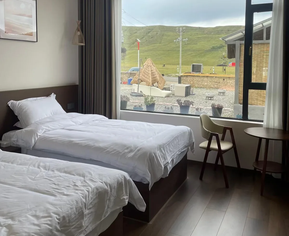
PSB Foreign Hotel Licensing Trap
- 60%+ Hotels Unlicensed: Over 60% of rural Tibetan guesthouses and roadside inns along western corridors lack Public Security Bureau (PSB) foreign guest entry terminals and cannot legally host you.
- Online Booking Mirage: Booking a room on Western booking sites does not guarantee check-in; front desks will flatly turn away foreign passports if their municipal system cannot scan foreign credentials.
- Sub-Zero Midnight Rejection: Arriving after an 8-hour mountain drive in freezing -5°C temperatures with no available licensed beds is a frequent, dangerous reality for uninformed DIY drivers.
- Hypothermia & Insulation Failure: Unlicensed budget motels lack central floor heating or dual-pane glass, drastically increasing severe hypothermia risks and rapid onset of pulmonary edema.
- Peak Season Scarcity: The limited certified foreign-compliant hotel rooms in hub towns (Bome, Bayi, Litang, Taxkorgan) sell out months ahead between June and October, driving surge prices.

AMS Hypoxia & Medical Emergency
- Rapid Elevation Shock: Ascending from low valleys to mountain passes over 4,000m within 24 hours induces Acute Mountain Sickness (AMS) in over 70% of unconditioned foreign drivers.
- "Climb High, Sleep Low" Rule: Sleeping at extreme elevations (like Litang 4,014m) on night 2 without staging triggers severe hypoxia; medical guidelines demand sleeping lower before pushing higher.
- HAPE & HACE Deterioration: High-Altitude Pulmonary or Cerebral Edema can develop within 6 to 12 hours from unmanaged headaches, requiring immediate emergency descent of at least 1,000 vertical meters.
- Zero English Emergency Care: Local township clinics and county hospitals have zero English-speaking personnel, no direct international insurance billing, and minimal ICU resuscitation capacity.
- Mini Can Oxygen Inadequacy: Disposable tourist spray cans provide less than 2 minutes of continuous oxygen; vehicles must be pre-equipped with 5L+ medical-grade oxygen generators.
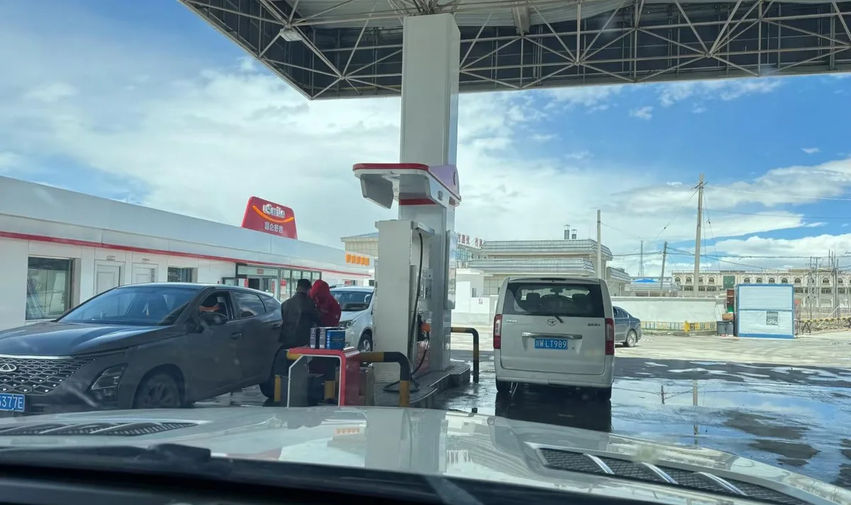
Gas Station ID Locks & Cold EV Drag
- Mandatory National ID Scan: Most PetroChina & Sinopec dispensers in sensitive plateau counties require scanning a Chinese Resident National ID (身份证) before the fuel nozzle mechanically unlocks.
- Manual Police Logging Delays: Foreign passport holders must locate the on-duty station manager for manual police registry photography, often delaying journeys by 40–60 minutes per fill-up.
- 200km+ High-Octane Supply Gaps: Premium 95 and 98-octane fuel frequently runs dry in remote mountain depots, risking engine knocking or complete stranding between distant service plazas.
- 40%–50% EV Range Collapse: Sub-zero mountain pass temperatures and cabin heating load slash electric vehicle range in half, with heavy liquid-cooled charging cables freezing rigid.
- 3x Energy Burn on Climbs: Sustained 30km uphill climbs consume energy at triple the standard rate; flatland dashboard estimates lead directly to battery exhaustion in dead zones.
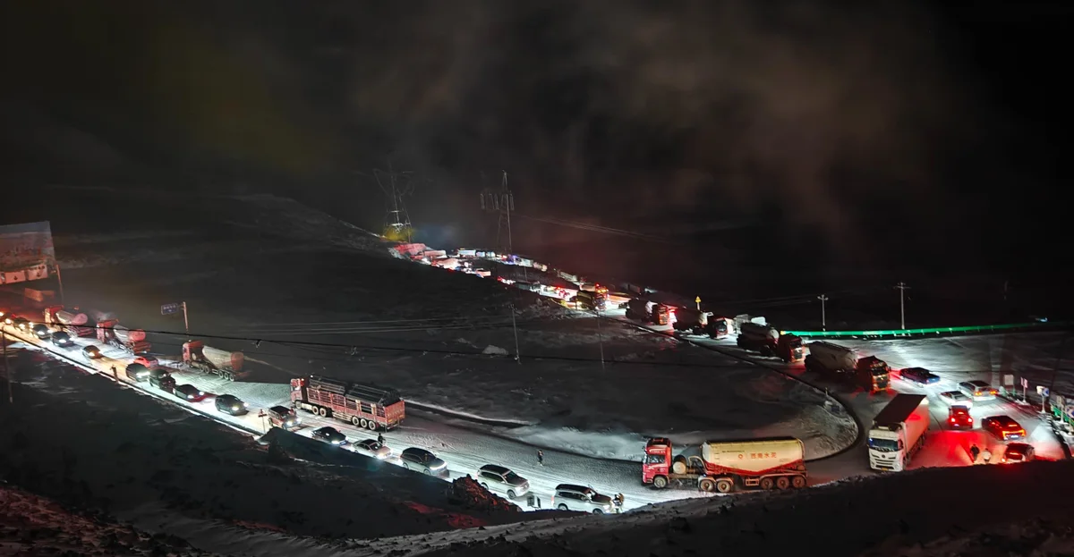
Blizzards, Landslides & Night Gridlock
- Rainy Season Mudslides (Jun–Aug): High-mountain gorges suffer massive rockfalls and mud avalanches, regularly cutting highway access for 24 to 72 hours without detour options.
- Sub-Zero Summer Blizzards: Even in midsummer, passes above 4,000m experience sudden whiteouts, trapping hundreds of vehicles overnight in freezing gridlock.
- Brake Fade on Switchbacks: Descending steep hairpin switchbacks continuously overheats brake pads; improper low-gear engine braking causes catastrophic brake failure.
- Invisible Black Ice (暗冰): Morning shadows and tunnel entrances conceal slick ice sheets, making standard rental tires skid violently without emergency snow chains.
- 35% Engine Power Drop: Naturally aspirated rental engines lose over a third of their horsepower in thin air, turning high-altitude overtakes around blind cliffs into lethal gambles.
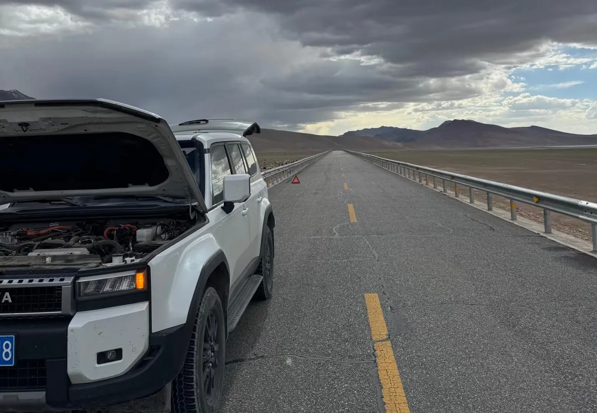
Zero-Signal Zones & No-Rescue Voids
- 50km+ Cellular Dead Zones: Deep canyon crevices and uninhabited mountain stretches have zero mobile signal; international roaming and Google Maps crash entirely without local offline tiles.
- No English 122/12122 Dispatch: Highway emergency rescue (12122) and police accident lines (122) operate exclusively in Mandarin; foreign drivers cannot communicate precise mile markers.
- 6–12 Hour Tow Arrival Times: In remote passes, the nearest heavy flatbed tow truck is hundreds of kilometers away, with commercial rescue fees exceeding 3,000–8,000 RMB.
- Lethal Hypothermia Risk When Stalled: If your vehicle battery or heating fails at 4,500m altitude at night, cabin temperature drops below -10°C within 30 minutes, risking acute hypothermia.
- Chinese GPS Audio Only: High-precision localized hazard alerts (Amap/Baidu) for imminent rockfalls, police radar, or tidal lanes are only broadcast in Chinese voice navigation.
Why High-Plateau Driving Demands an Expert Itinerary Blueprint
A generic travel blog tells you where the scenery is pretty. It will not tell you which checkpoint will seize your rental keys, which county inn will turn away your passport in -5°C midnight cold, or how to avoid fatal cerebral edema at 5,000 meters.
- •Turned back at Jinsha River checkpoint; 10+ days vacation and flights completely wasted.
- •Midnight check-in rejection by unlicensed county motels; forced to sleep in freezing cars.
- •Stranded at gas stations unable to unlock fuel pumps without a Chinese Resident ID.
- •Severe altitude sickness and ICU visits due to reckless 3,500m single-day elevation spikes.
- •Helpless in zero-signal mudslide closures with no English-speaking emergency assistance.
- •100% Legally Compliant Routing: Checkpoint protocols & pre-screened foreign travel permits.
- •Verified Foreign-Licensed Hotels: Pre-screened lodgings with confirmed public security capability (外宾资质).
- •Bilingual Navigation Waypoints: Chinese characters & Pinyin cards for seamless Amap (高德) entry.
- •Medical Elevation Pacing: Scientifically sequenced "climb high, sleep low" stages preventing acute AMS.
- •Alternative Plan B Road Book: Severe weather & mountain pass landslide detour contingency guides.
Bilingual Emergency Flashcards for Pamir Motorists
Cell phone voice translation apps will fail when offline on mountain passes. Screenshot these verified Mandarin and Pinyin emergency cards to present to passing drivers, local Tajik herders, or police officers.
Frequently Asked Questions (FAQ)
Detailed answers regarding permits, vehicle requirements, one-way enforcement, and safety on Panlong Ancient Road.
Can foreign tourists legally rent a car and drive Panlong Ancient Road independently?
Yes, 100% legally. Foreign nationals who hold a valid Chinese Provisional Driving Permit (临时机动车驾驶许可) can rent a vehicle in Kashgar and drive the Karakoram Highway (G314) up to Tashkurgan, and then independently navigate the entire Panlong Ancient Road (Wacha Highway). You do NOT require an organized tour group, Chinese escort guide, or commercial travel agency booking. You only need your original passport, valid Chinese visa or visa-free entry stamp, Chinese driving permit, and rental contract.
Do foreign passport holders need a Frontier Defense Permit (边境通行证) for Tashkurgan and Panlong?
No. This is one of the most common misunderstandings about Xinjiang border travel. The "Frontier Defense Permit" (边境通行证) issued by the Kashgar administrative hall is exclusively required for mainland Chinese citizens with Resident ID cards. Foreign citizens cannot be issued this domestic document. Instead, foreign nationals simply show their original physical passport and visa at the Gez Frontier Inspection Station (盖孜检查站) on the G314 highway. The border police enter your passport details into the national border management system and clear you to proceed.
How many hairpin turns are there really on Panlong Ancient Road?
Panlong Ancient Road features 639 hairpin switchback curves along its 34-kilometer mountain crossing. It is officially divided into two sectors: Big Panlong (大盘龙), which features broader sweeping mountain turns climbing toward the summit ridge, and Small Panlong (小盘龙), which contains over 200 ultra-dense, tight 180-degree hairpin switchbacks packed into 5 kilometers of steep descent.
Is 4WD (four-wheel drive) required to drive Panlong Ancient Road?
No. The entire road was completely paved with smooth, modern high-grade asphalt in 2019 to improve transportation for the Tajik ethnic township of Wacha. A standard 2WD front-wheel drive rental car (such as a Volkswagen Lavida, Buick Excelle, or compact crossover) can easily drive the highway during the open season (May to October). High ground clearance is convenient but not strictly necessary since there are no deep ruts or rocks on the paved surface.
Why is engine braking (low gear) essential on Small Panlong?
Small Panlong descends over 600 vertical meters across non-stop hairpin turns in just a few kilometers. If an inexperienced driver leaves an automatic vehicle in standard "Drive" (D) and controls speed by holding down the brake pedal, the continuous friction will heat the brake pads and rotors to over 400°C within 8 to 10 minutes. This causes brake fluid vaporization and sudden total brake loss (brake fade), which is fatal on sheer cliff switchbacks. Drivers must manually shift to low gear (M1, M2, or L) to allow engine vacuum compression to maintain a safe crawling speed of 20 to 25 km/h.
What is the full driving loop from Tashkurgan and back?
Most motorists complete Panlong Ancient Road as a circular loop starting and finishing in Tashkurgan county town: (1) Depart Tashkurgan heading south on G314 for approx. 14 km; (2) Turn east onto the western entry portal of Panlong Ancient Road; (3) Ascend Big Panlong, cross the 4,200 m crest, and descend Small Panlong into Wacha Township (approx. 34 km); (4) At Wacha, turn northwest onto the paved valley connector road passing Xiabandi Reservoir (下板地水库) and the Tashkurgan River canyon (approx. 45 km); (5) Re-enter Tashkurgan county town. Total loop distance is roughly 95 km and takes 3.5 to 5 hours including photo stops.
Are large vehicles or campervans (RVs) allowed on Panlong Ancient Road?
No. Traffic police strictly restrict vehicle access to passenger cars with 7 seats or fewer and overall length under 6.0 meters. Full-size tour buses, motorhomes (房车), camper vans with long wheelbases, and vehicles towing trailers are strictly prohibited because they cannot clear the turning radius on the tightest switchbacks without blocking both lanes or scraping their chassis on the roadbank.
When does Panlong Ancient Road open and close for the season?
Due to severe snowdrifts and sub-zero ice at the 4,200 m mountain pass, Panlong Ancient Road operates on a seasonal basis. It generally opens to civilian tourist traffic in early to mid-May and closes for the winter season in late October or early November depending on initial heavy snowfall. Local traffic police issue seasonal opening and closure notices via the Tashkurgan Public Security WeChat channel.
How severe is altitude sickness along the Panlong drive?
Tashkurgan county town sits at 3,100 meters, while the Panlong mountain summit reaches 4,200 meters. Most healthy travelers who spent the previous night in Tashkurgan adapt well, but mild headaches, breathlessness, and rapid pulse are common when stepping out of the vehicle at the summit viewing platform. Drink plenty of water, avoid running or jumping for photos at the crest, and carry portable aerosol oxygen cans in your rental car.
Can I fly a camera drone over Panlong Ancient Road?
Yes, drone photography is extremely popular on Panlong because the serpentine pattern of the 600 switchbacks is best appreciated from an aerial bird’s-eye perspective. However, you must: (1) Ensure your drone is registered on the CAAC platform; (2) Never fly higher than 120 meters above ground level; (3) Avoid flying in strong summit gale winds, which can quickly trigger battery failsafes or blow lightweight quadcopters away; (4) Never fly toward military installations or border security watchtowers.
Where can I refuel and recharge electric vehicles around Panlong?
Refueling is available in Tashkurgan county town at both PetroChina and Sinopec stations, which stock 92# and 95# gasoline and 0# / -35# diesel. There are NO petrol stations along the 34 km Panlong mountain stretch itself or in small Wacha village. Top up your fuel tank in Tashkurgan before departing. EV fast charging stations are available in Tashkurgan town at major hotel parking lots, but driving an EV up to 4,200 m consumes substantial battery charge during the climb.
Can foreigners stay overnight in Tajik family homestays in Wacha Township?
In Wacha Township and surrounding small rural pastures, most local Tajik family homestays (农家乐/民宿) do NOT have the specialized electronic foreign guest registration software linked to the Kashgar Public Security Bureau. Unless the specific homestay explicitly confirms foreign guest capability, international travelers should return to Tashkurgan county town for overnight lodging, where numerous 3-star and 4-star hotels regularly register foreign guests.
Next Step: Connect Your Kashgar & Pamir Highway Itinerary
Explore companion road guides across western Xinjiang, car rental desks at Kashgar Airport, and custom trip planning.
Connect east from Kashgar through Hotan and Minfeng.
Cross the Taklamakan Desert dunes from Minfeng to Luntai.
Fleet options, foreign provisional permit desks, and depot locations.
Foreign hotel verification and custom Kashgar loops.